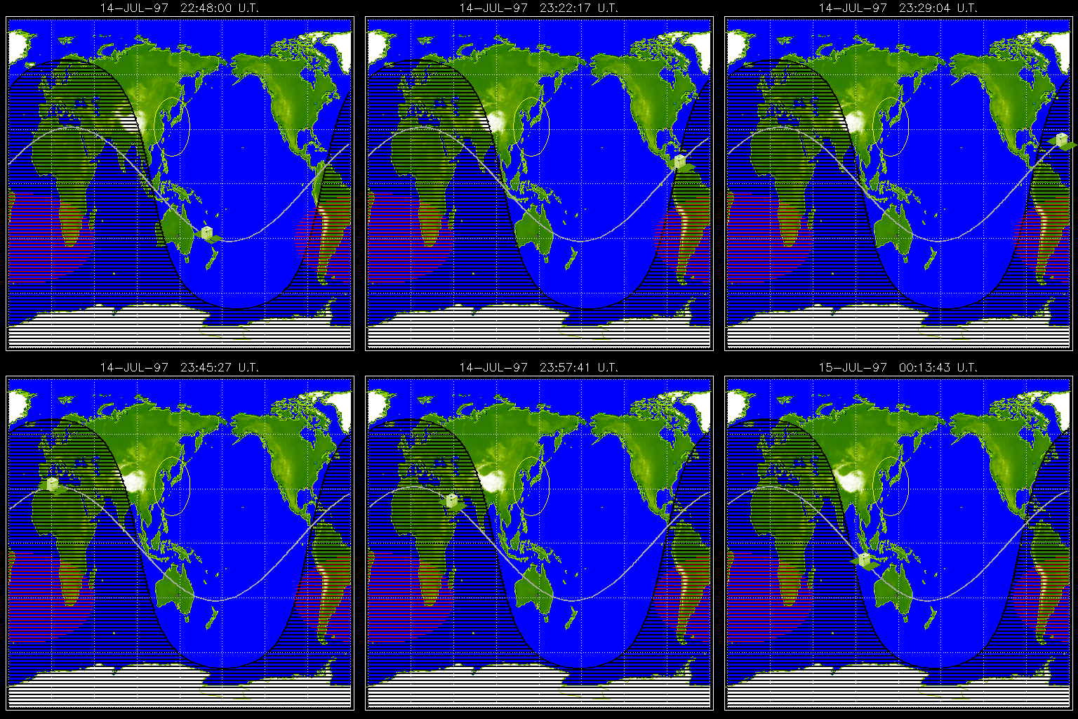
 There
are some really important things to notice on the map.
  There
are some really important things to notice on the map.
By watching the satellite over several hours, you can determine how
long it takes for Yohkoh to go around Earth once (if you don't want to
watch the satellite every 15 minutes or so - there is an archive movie available). The
current Yohkoh position map is found at http://www.lmsal.com/cgi-diapason/yopos.
Click the image and hit RELOAD so see the updated
position. Determine the length of time for one orbit of the Yohkoh
spacecraft.
![]()
![]() Back
to the Internet Tracking or onward to Orbital
Velocity Measurement
Back
to the Internet Tracking or onward to Orbital
Velocity Measurement![]()
![]()
Lesson designed by the YPOP
Team
For questions about this lesson, please contact
Tim Slater